Mount Blue Sky Scenic Byway (formerly Mount Evans)
Idaho Springs → Mount Blue Sky summit, CO · ~28 miles to the summit · half to full day
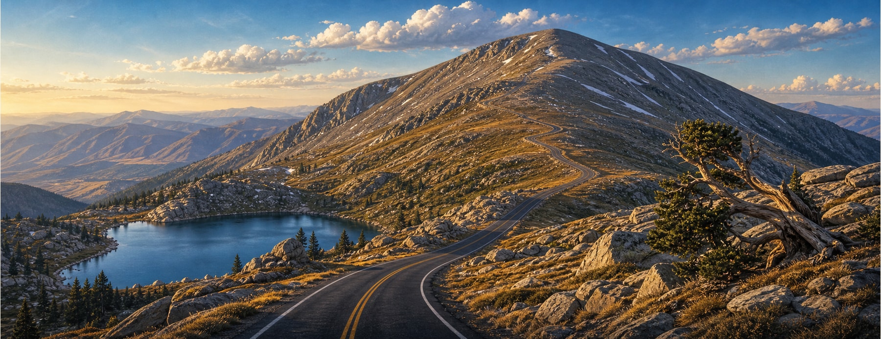
The Mount Blue Sky Scenic Byway — renamed from the Mount Evans Byway after the peak was renamed in 2023 — climbs over 7,000 feet from Idaho Springs to about 14,130 feet, the highest paved road in North America, past alpine lakes and thousand-year-old bristlecone pines to a tundra summit.
Good to know: Reopened in 2026 after major reconstruction and now requires a timed-entry reservation via Recreation.gov (small fee). Seasonal and weather-dependent, with no guardrails up top — and altitude sickness is real above 14,000 ft.
The highest paved road in North America.
Drive higher than almost anywhere on the continent, past bighorn sheep, mountain goats, and ancient bristlecones to a 14,000-foot summit.
States on this route
The signature stops
What to pull over for.
Plan the drive
Build your Mount Blue Sky Byway trip.
Roamward turns the route into a real itinerary — the scenic line, the gems worth a detour in every state, and where to stay. Join early access for the iOS beta.
Build a trip around a drive like this.
Roamward turns spots like this into a real road trip on your phone — the scenic drive, the stops, and the detours, planned around the vibe you’re after. Get early access: