Mount Washington Auto Road
Pinkham Notch → Mount Washington summit, NH · 7.6 miles to the summit · half day
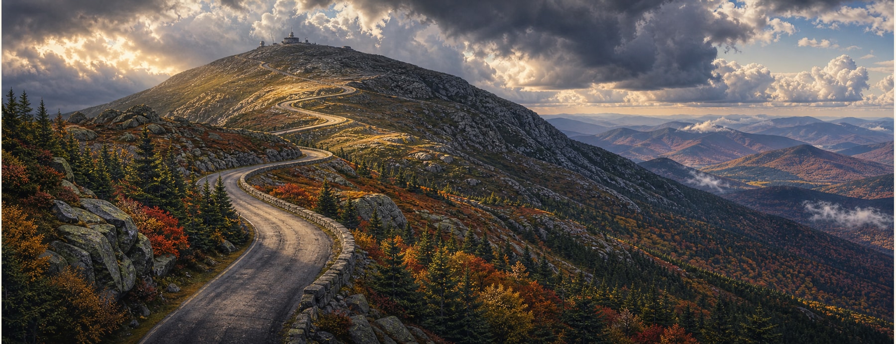
Opened in 1861, the Mount Washington Auto Road climbs 7.6 miles and nearly 4,650 feet from Pinkham Notch to the 6,288-foot summit of Mount Washington — the highest peak in the Northeast, famous for some of the worst weather on Earth.
Good to know: A toll road, open seasonally and weather-dependent — the summit can close with little notice. Grades are steep; shift to low gear coming down, and guided van tours run if you’d rather not drive it.
Drive to the roof of the Northeast.
Switchback through four climate zones to a summit that once clocked a 231-mph wind — and earn the classic “This Car Climbed Mt. Washington” bumper sticker.
States on this route
The signature stops
What to pull over for.
Plan the drive
Build your Mt Washington Auto Road trip.
Roamward turns the route into a real itinerary — the scenic line, the gems worth a detour in every state, and where to stay. Join early access for the iOS beta.
Build a trip around a drive like this.
Roamward turns spots like this into a real road trip on your phone — the scenic drive, the stops, and the detours, planned around the vibe you’re after. Get early access: